Posts: 1,709
Threads: 2
Joined: Aug 2014
Reputation:
34
Since sidewalk is only on the south side of seagram, you're likely already there. If you're already there, you're likely to try to cut diagonally across the soccer pitch, which leads you into this trouble. Detour signs for this likely scenario would be needed.
Posts: 2,015
Threads: 11
Joined: Oct 2014
Reputation:
77
09-08-2016, 03:36 PM
(This post was last modified: 09-08-2016, 06:10 PM by Pheidippides.)
More uptown updates:
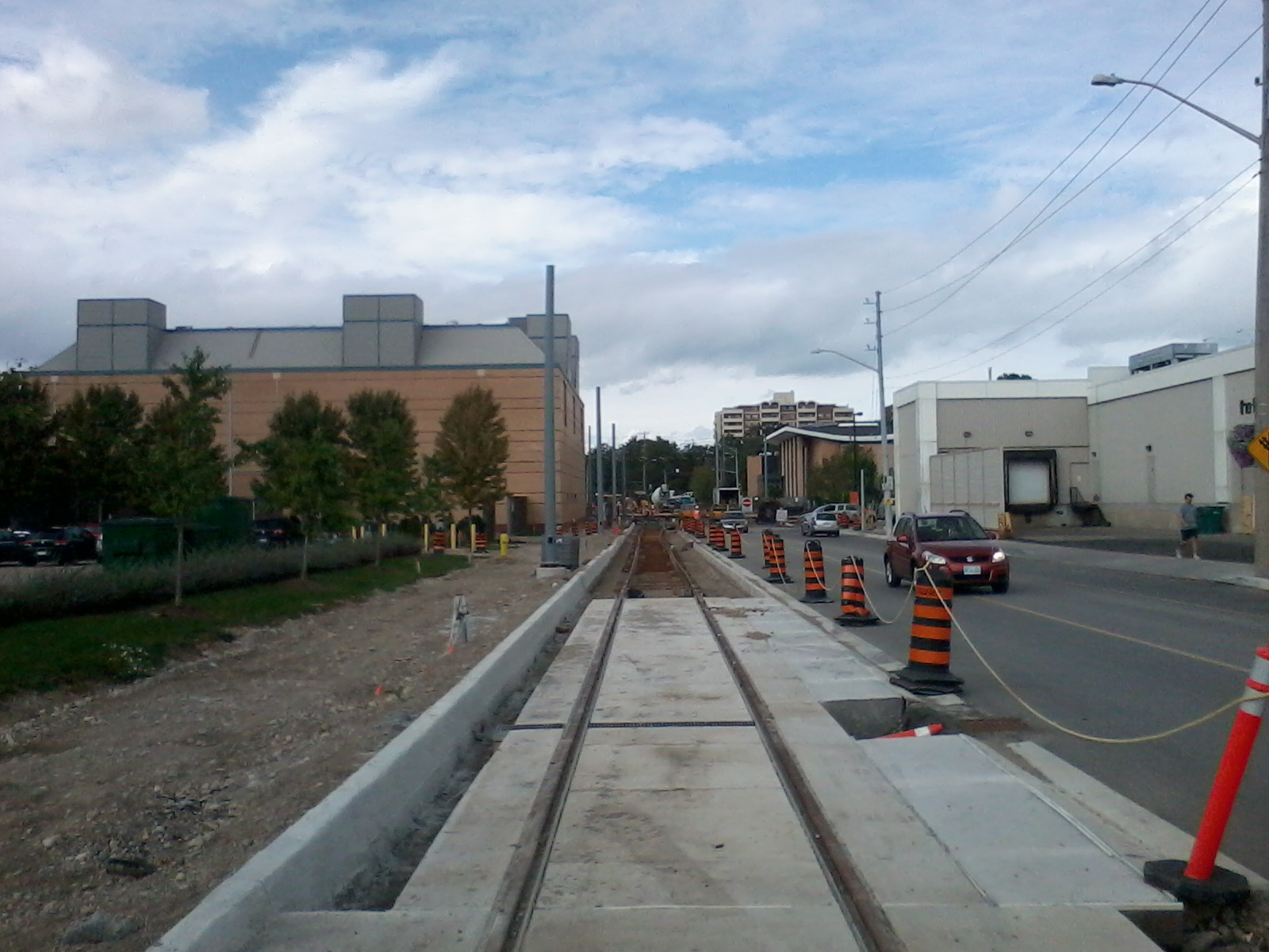
-curbs at Erb and Caroline are now in on the south east, north east, and most of the north west (recall south west are already in)
-the SB track now connects to the embedded track on Caroline and swings around the corner
-this corner is really rounding into form quickly; the original scheduled closure was may 16 for four months (which is next week) which they will not meet but probably won't be too long after that then William will close again
-it looks like they are fixing another whoops just north of the willis station on Caroline; a whole pile on concrete was jackhammered out around the embedded track
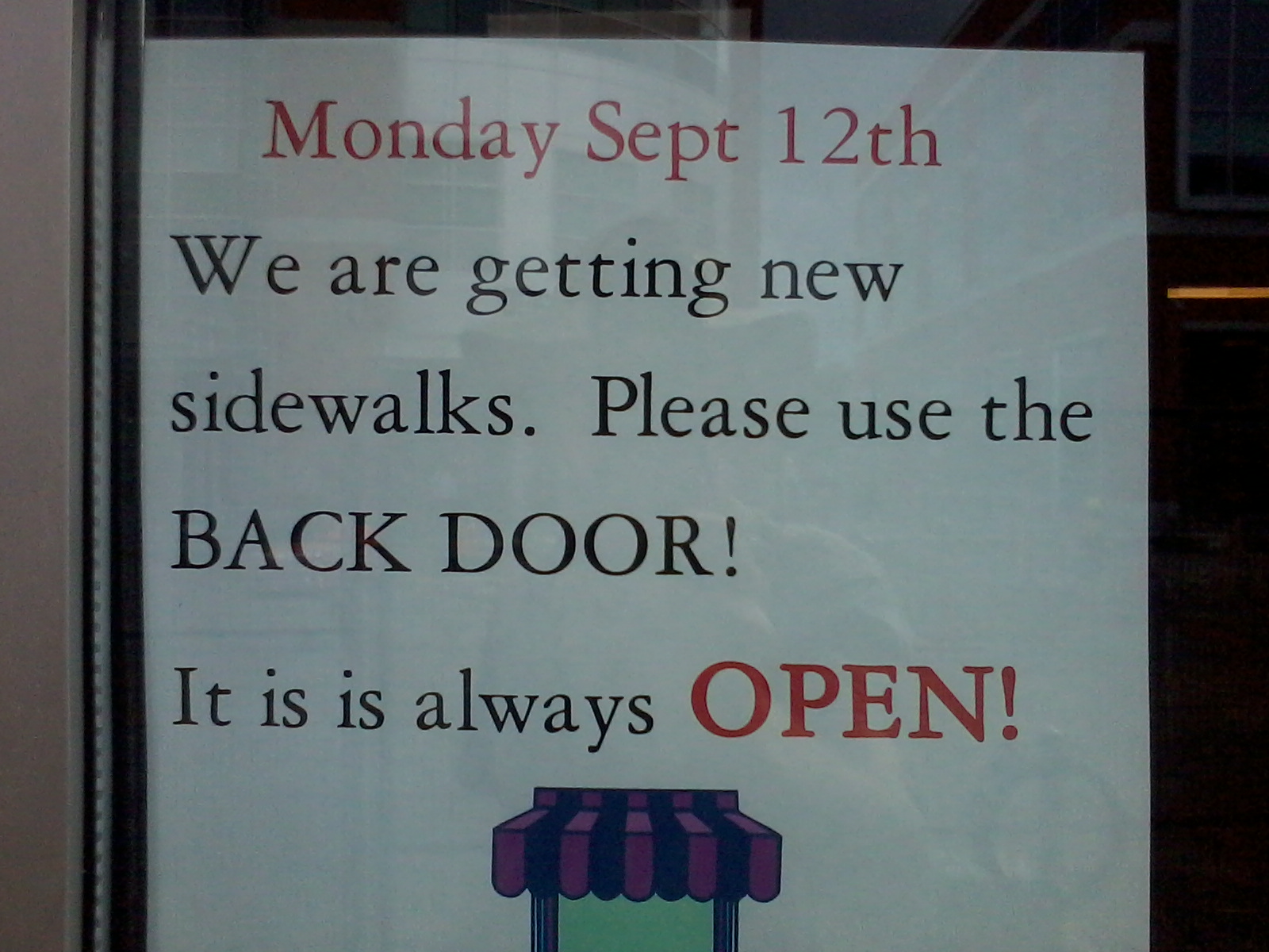
-according to eating well organically new sidewalks are going in on at least part of the east side of king starting September 12


Everyone move to the back of the bus and we all get home faster.
Posts: 6,905
Threads: 32
Joined: Oct 2014
Reputation:
224
09-08-2016, 07:51 PM
(This post was last modified: 09-08-2016, 07:57 PM by Canard.)
Love your photos, Brian! You have an incredible vantage point - much appreciated.
In other news, the Rapid Transit team has released a new map, this one showing which streets the system will operate on. For someone as directionally-challenged as me, this is a great help.
 http://rapidtransit.regionofwaterloo.ca/...access.pdf
Posts: 7,579
Threads: 36
Joined: Jun 2016
Reputation:
196
(09-08-2016, 07:51 PM)Canard Wrote: Love your photos, Brian! You have an incredible vantage point - much appreciated.
In other news, the Rapid Transit team has released a new map, this one showing which streets the system will operate on. For someone as directionally-challenged as me, this is a great help.
http://rapidtransit.regionofwaterloo.ca/...access.pdf
That's an interesting map, although for me, it was somewhat cut off.
I think there is a small error though.
The Huron Spur begins at the end of Borden, and that Borden does not turn south and meet Ottawa.
Unrelated, does anyone know if the tracks alongside Courtland will be embedded or ballasted?
Posts: 1,971
Threads: 18
Joined: Aug 2014
Reputation:
37
(09-08-2016, 02:24 PM)plam Wrote: Seagram didn't look especially open with machinery operating, though the detour signs say to cross there. Also there's no level crossing so you actually have to lift your bike over the tracks. So it's not just the sign that's missing, but also making Seagram look open.
"A portion of Seagram Drive will be closed for ION-related construction work until approximately September 20. The section, from the Ring Road to Lester Street, will have pedestrian access maintained at all times."
So you are allowed to walk across but there are a whole bunch of active machines... doesn't seem like the best thing to do!
Posts: 516
Threads: 1
Joined: Sep 2014
Reputation:
20
09-08-2016, 10:45 PM
(This post was last modified: 09-08-2016, 10:58 PM by MacBerry.)
(09-07-2016, 02:13 PM)tomh009 Wrote: Cat poles being installed at the Queen St station. I didn't think this would happen until the rest of the concrete was poured for the station platform, but here we are ...
I always think of this downtown parking garage as a prison building given it's wired windows look.
![[Image: attachment.php?aid=2187]](http://www.waterlooregionconnected.com/attachment.php?aid=2187)
Posts: 516
Threads: 1
Joined: Sep 2014
Reputation:
20
(09-08-2016, 12:14 PM)Canard Wrote: So you're saying people are doing this (heading from North to South)? A is start, B is point of realization of error, C is finish:
Why would they stay on the south side? The trail is on the North side. They should cross over at Seagram before even crossing it... I just don't get (even before construction) why anyone would be walking on the South side of the tracks. There's nothing there and if you got to "B" there's no bridge, crossing, anything. It's never been anything but a dead end.
I think eventually it might be closer to take our new LRT from Waterloo Square to Laurier station 
Posts: 4,328
Threads: 1
Joined: May 2015
Reputation:
180
(09-08-2016, 09:55 PM)plam Wrote: (09-08-2016, 02:24 PM)plam Wrote: Seagram didn't look especially open with machinery operating, though the detour signs say to cross there. Also there's no level crossing so you actually have to lift your bike over the tracks. So it's not just the sign that's missing, but also making Seagram look open.
"A portion of Seagram Drive will be closed for ION-related construction work until approximately September 20. The section, from the Ring Road to Lester Street, will have pedestrian access maintained at all times."
So you are allowed to walk across but there are a whole bunch of active machines... doesn't seem like the best thing to do!
The quotation is incorrect. Pedestrian access is not being maintained. Which doesn’t upset me itself, but I fail to see why they can’t be accurate and why they can’t have clear signage. Also, why they can’t have the new crossing south of the platform open before closing Seagram Dr. to pedestrians. It’s just a lack of caring really as far as I can tell.
Posts: 6,905
Threads: 32
Joined: Oct 2014
Reputation:
224
09-09-2016, 06:19 AM
(This post was last modified: 09-09-2016, 06:20 AM by Canard.)
I'll take some photos over the weekend and get in touch with my contacts and see if they can get some signage or clarity here. If somebody could make me a map/diagram of the problem better than my MS Paint hack job images, it's probably help.
Posts: 10,275
Threads: 65
Joined: Sep 2014
Reputation:
296
Lots of work happening on the E end of Charles.
Charles St, looking toward Borden Ave:

Embedded track concrete has now been poured at the Borden Ave intersection:

Most of the stretch between Borden Ave and Ottawa St is also poured. A small gap remains, plus the Ottawa intersection is not yet started:

Posts: 252
Threads: 1
Joined: Sep 2014
Reputation:
9
Yesterday on my ride home the construction workers were allowing us to walk our bikes across Seagram (lots of trenches dug already so would have been impossible to ride). This morning I tried to walk the bike across and the construction worker said we had to go up to University for the pedestrian crossing. So the only way of getting from one side of Waterloo Park to the other (or one side of Seagram to the other) is now either University Ave, or the crossing south of the lake.
Posts: 6,905
Threads: 32
Joined: Oct 2014
Reputation:
224
09-09-2016, 09:46 AM
(This post was last modified: 09-09-2016, 09:46 AM by Canard.)
What did it look like they were doing at the crossing?
Posts: 252
Threads: 1
Joined: Sep 2014
Reputation:
9
They've dug small trenches around the tracks, preparing to pour concrete maybe? Hopefully whatever work they're doing will also include repaving the Laurel Trail between Seagram and University, which has been out of commission all summer.
Posts: 10,275
Threads: 65
Joined: Sep 2014
Reputation:
296
Queen St station platform concrete pour now in progress:

Posts: 6,905
Threads: 32
Joined: Oct 2014
Reputation:
224
(09-09-2016, 10:01 AM)goggolor Wrote: They've dug small trenches around the tracks, preparing to pour concrete maybe? Hopefully whatever work they're doing will also include repaving the Laurel Trail between Seagram and University, which has been out of commission all summer.
A bit rough, perhaps, but certainly not out of commission. I don't know what it looked like prior to construction (I only became a cyclist in May), but I've used it a couple of times a week since then and it's never been closed. I haven't been over there since Sunday though so I'm not sure where things are at.
|


