Posts: 419
Threads: 1
Joined: Jun 2015
Reputation:
32
Anyone have a webcam to point at the various intersections as burn-in and service begins? There's some YouTube money in it for crash-and-near-miss videos (cf. http://11foot8.com/ ). I imagine Shopify's new spot at Erb@Caroline'd be of particular note, as would the residential blocks at King@Vic.
Posts: 6,905
Threads: 32
Joined: Oct 2014
Reputation:
224
1/2 - Thursday, October 6, 2016
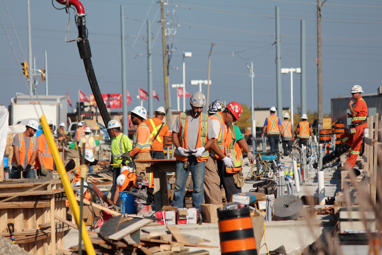
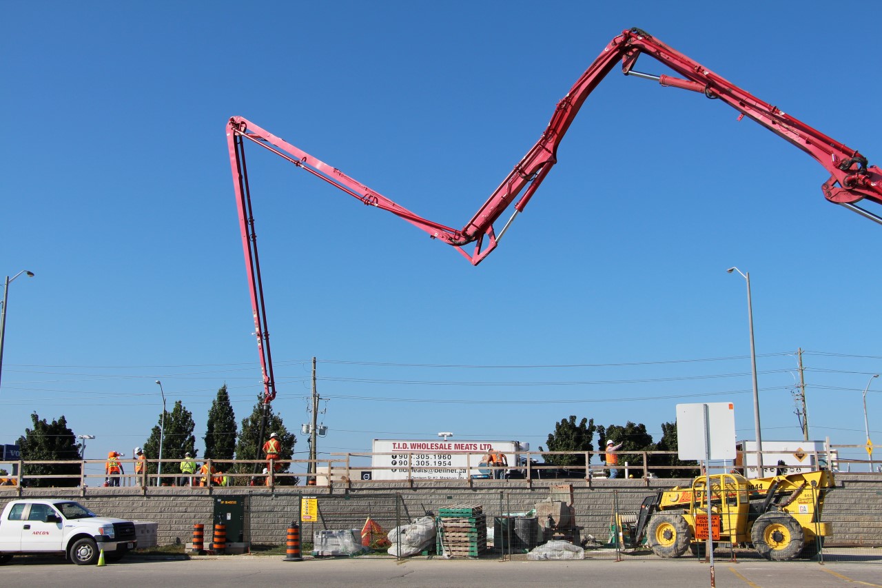
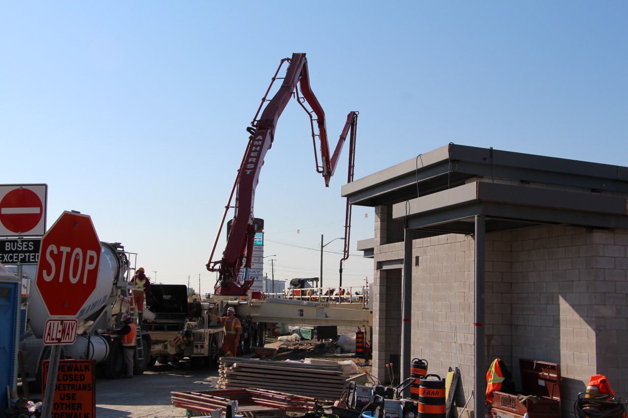
An incredible flurry of activity at Conestoga today! I was lucky enough to be able to catch the action mid-day.
Posts: 6,905
Threads: 32
Joined: Oct 2014
Reputation:
224
Posts: 54
Threads: 0
Joined: Apr 2016
Reputation:
0
(10-06-2016, 06:42 PM)Canard Wrote: 2/2 - Thursday, October 6, 2016
Great Shots.
Posts: 73
Threads: 0
Joined: Oct 2014
Reputation:
1
Wow that's at least 24 construction workers at one spot, intense!
Posts: 4,387
Threads: 15
Joined: Aug 2014
Reputation:
121
THe cinderblock structure in the third photo - is that the operators' shelter? Didn't realize it was that far along.
Posts: 2,015
Threads: 11
Joined: Oct 2014
Reputation:
77
Ottawa approaching Charles:
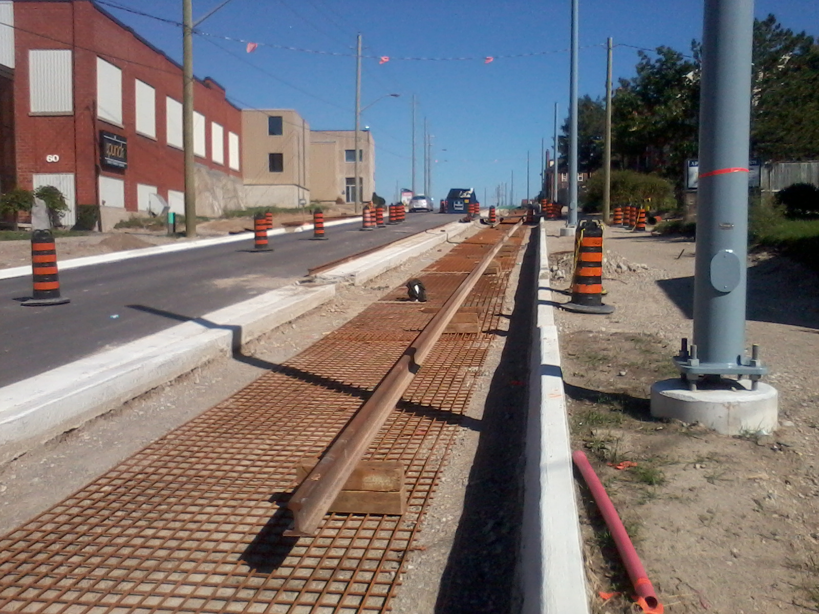
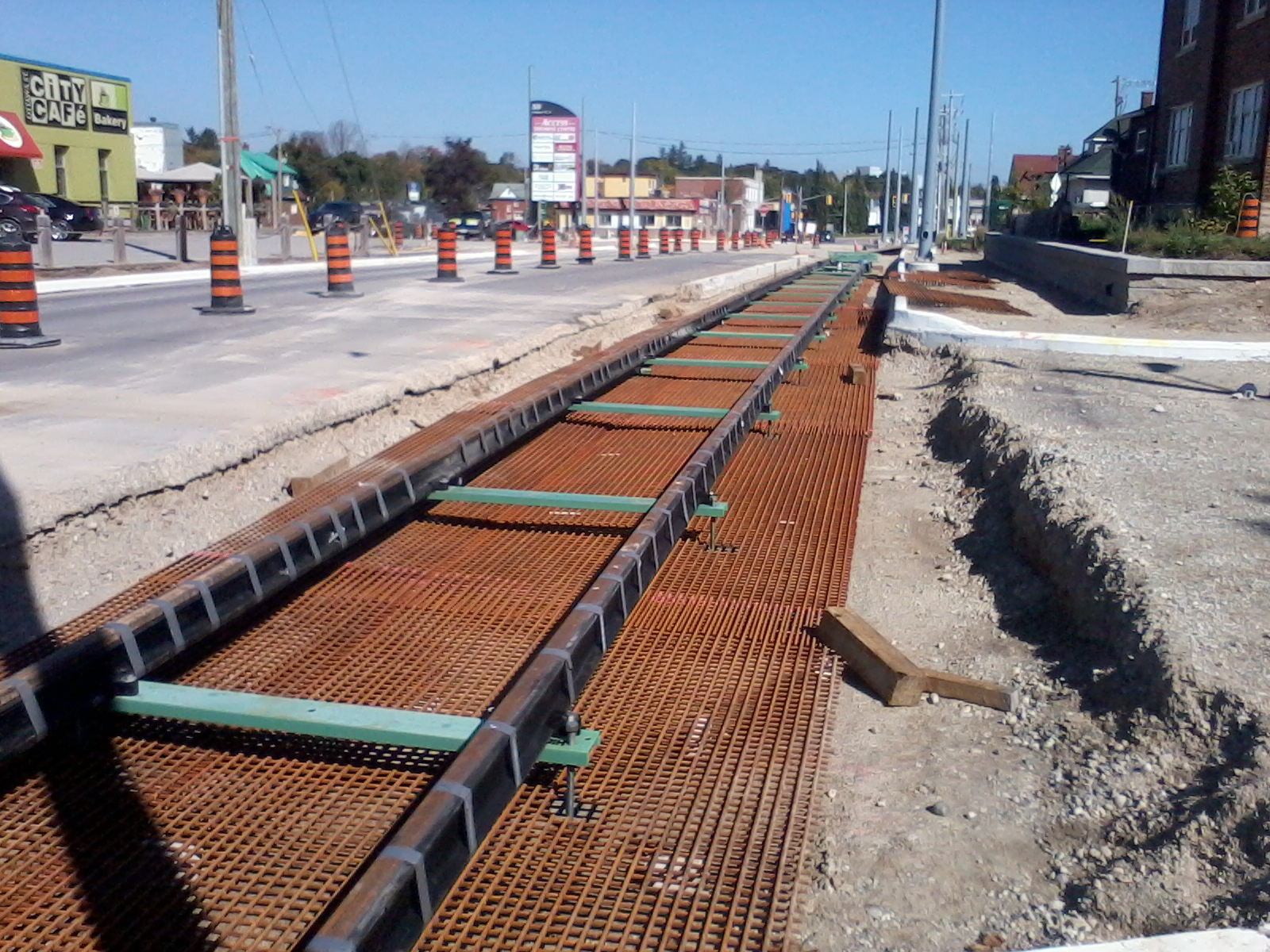
TPSS @ Borden:
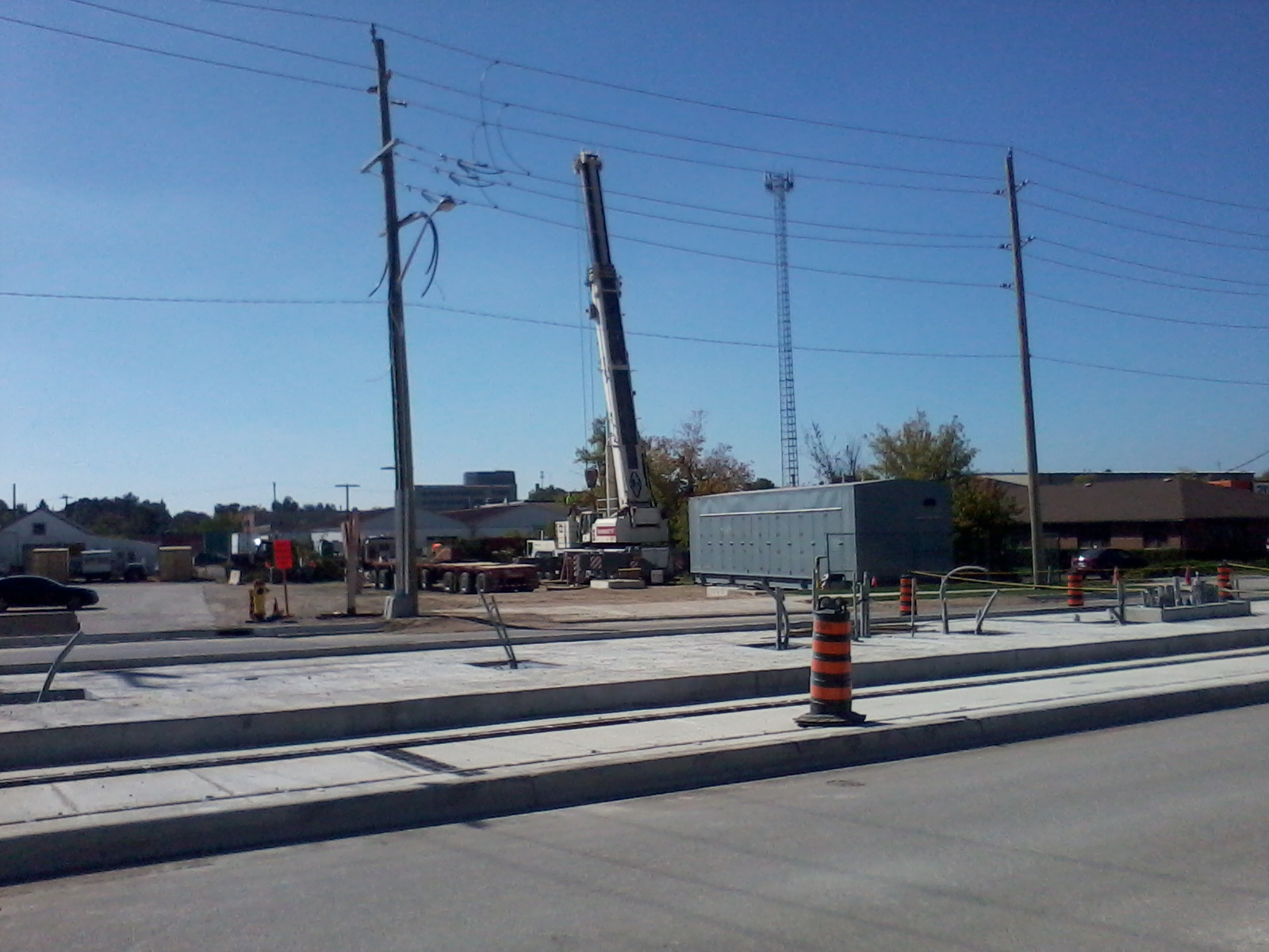
Everyone move to the back of the bus and we all get home faster.
Posts: 1,467
Threads: 5
Joined: Sep 2014
Reputation:
41
(10-02-2016, 01:11 PM)Canard Wrote: Facing the right way, now - a ridiculously slow speed along Charles. This really irritates me and I'm very disappointed in this. At 25 km/h, I'll be passing trains on my bike!
Perhaps its a problem of perception in this picture, but the 25 km/h sign seems to be immediately before an S-curve in the track.
(10-03-2016, 04:12 PM)Pheidippides Wrote: What exactly do the "resume safe speed" signs mean? They would seem to imply that the vehicle was previously traveling at an unsafe speed.
(10-04-2016, 05:56 PM)Pheidippides Wrote: Those resume safe speed signs are popping up everywhere I saw another one in front of Charles St. Terminal and another one in the Victoria Park station.
"Safe Speed" may be a generic term with a defined speed that trains should be traveling along the track when they are in the vicinity of limited visibility, near a platform or crossing. For instance, when operating heavy rail equipment, trains must travel at a speed where they can safely come to a stop in half the distance visible looking in the direction of travel.
Alternately, as defined by the Track Design Handbook for Light Rail Transit (US FTA, circa 2012), "Safe Speed" is "the speed limit above which the vehicle becomes unstable and in great danger of derailment upon the introduction of any anomaly in the roadway."
Posts: 6,905
Threads: 32
Joined: Oct 2014
Reputation:
224
10-07-2016, 07:53 PM
(This post was last modified: 10-07-2016, 09:36 PM by Canard.)
(10-07-2016, 02:18 PM)nms Wrote: Perhaps its a problem of perception in this picture, but the 25 km/h sign seems to be immediately before an S-curve in the track.
Exactly correct. Those curves are rated for 29 km/h, so the 25 km/h limit makes sense. I did not realize this at the time of my post.
Edit: Sorry, it's the curves further down (C20-5, C20-6) that are rated 29 km/h. Curves C20-3 and C20-4 are at Water and are designed for 23 km/h. So actually now I'm surprised this isn't posted 20 km/h!
Posts: 1,084
Threads: 2
Joined: Aug 2014
Reputation:
31
Tracks are across Block Line. No forms yet, but close.
I hope the project team resurfaces Block Line up towards Hayward when complete. It's a bit of an off-road experience through there.
Posts: 4,387
Threads: 15
Joined: Aug 2014
Reputation:
121
Tracks are also across Ontario at Duke, and booted too. I didn't see ties (though it was dark and I wasn't that close) and certainly no forms.
Posts: 720
Threads: 11
Joined: Aug 2014
Reputation:
92
10-07-2016, 11:27 PM
(This post was last modified: 10-07-2016, 11:29 PM by Lens.)
First layer of the Fairview Park platform is poured and the station area is coming along slowly.
Posts: 6,905
Threads: 32
Joined: Oct 2014
Reputation:
224
(10-06-2016, 08:13 PM)curiouschair Wrote: Wow that's at least 24 construction workers at one spot, intense!
My pictures didn't show the whole area; it was more like 50-75!
Posts: 47
Threads: 0
Joined: Nov 2014
Reputation:
-1
Getting close to laying track in Uptown Waterloo.
Posts: 103
Threads: 0
Joined: Aug 2016
Reputation:
2
I notice there are a lot of left turn restrictions for drivers on Caroline and King now that the roads are reopening. Makes sense given there is only space for a single lane now but will be interesting to see how it affects traffic patterns. Here are the ones I can remember:
King NB to Allen WB (sign is currently covered since William is closed)
Caroline NB to William WB
Caroline NB to Erb WB (this will get a lot of people who aren't familiar with the area, hopefully they put something at FDB telling people to turn there)
Caroline SB to Willis Way EB and William EB (not sure what the alternatives are here if you aren't coming from Erb)
King SB to John EB
King SB to Union EB -- this one surprised me a bit, there is a dedicated right turn lane and Union is a relatively major road. There is a u turn signal at Mt hope to come back around if you're desperate.
Also, no left turns from pine onto king. They must have decided signs weren't enough because they built a concrete island to physically block it.
|


